

To map the river bed profile for 20 km stretch and determining Width of water flow, Maximum depth of water, Mean depth of water, Area of water flow, Mean velocity of water, Average Discharge of water, Salinity, Temperature, Turbidity at four sections for continuous four days per season for three different seasons.
Project Start Date: 12/03/2019Project Type:
- Business Project
- Conducting bathymetry surveys over 20km stretch of the river in a grid manner of size of 50m and determining river bed profile.
- Measuring continuous Tide Levels of river at four sections for continuous four days at a stretch per season, in three different seasons
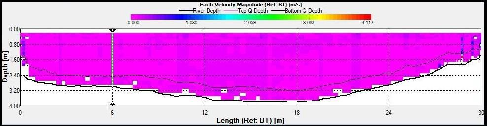
- Conducting Hydrographic Survey across river using Acoustic Doppler Current Profiler at four sections for four days at a stretch per season, for three different seasons and determining:
- Width of water flow
- Maximum depth of water
- Mean depth of water
- Area of water flow
- Mean velocity of water
- Average Discharge of water
- Determining Salinity, Temperature, Turbidity at sections A, B, C, D for four days per season for three different seasons.
- Testing of Water Samples, Bed samples and Suspended sediment samples.